Department of Defense: Geographic Information Systems
In the war on terrorism, American special forces hunt an elusive enemy through terrain characterized more by boulders and caves than well-marked roads or developed infrastructure.
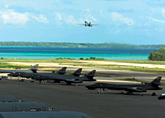
In the war on terrorism, American special forces hunt an elusive enemy through terrain characterized more by boulders and caves than well-marked roads or developed infrastructure. Even so, it's likely battle planners will turn to geographic information systems, or GIS, to provide troops with detailed views of terrain and elevation. No matter the topography ? mountains, deserts, plains, inhabited urban areas ? GIS enables commanders to pinpoint distinctive physical characteristics, from back alleys and munitions caches to vegetation and creek beds.Although 21st-century warfare may be conducted far from the plains of Central and Eastern Europe as envisioned during the Cold War, determining the precise lay of the land remains a central military priority."We're seeing GIS being deployed in every level of the defense domain," said David Swann, defense market manager for Environmental Systems Research Institute Inc. of Redlands, Calif., one of the world's largest GIS companies. "Almost every defense decision has geography or terrain factored into it. We're seeing information technology generally, and GIS specifically, providing incredible support to the warfighter."Such support does, however, remain centralized. Although GIS systems are being deployed on some combat-ready laptops and handhelds, on select naval vessels and soon on next-generation tanks, collecting and disseminating GIS data usually occurs at the headquarters level. Dissemination in the field is not routine, nor is it expected to be for some time."GIS is very useful in deployment, moving troops from one area to another. Use on the battlefield is more problematic," said Mary Hiatt, vice president of GIS company EarthData International in Gaithersburg, Md., an affiliate of parent EarthData Holdings in Washington. "How do you get this digital information efficiently to units in the field? In battle, conditions aren't exactly ideal."XXXSPLITXXX-GIS remains a computer- and labor-intensive endeavor, with much human involvement in compiling spatial databases of facts and figures that have a direct relationship to the physical world. In creating GIS imagery, analysts combine pictures taken from airplanes or satellites with topographical data, leavened by adding other statistical information on general infrastructure and more specific factors, such as agricultural activity, population density, street layouts, location of utilities and the type and number of private- and public-sector enterprises.Experts also factor in data derived from disparate fields, such as census taking, zoning, utility planning and maintenance, traffic analysis, redistricting, bus routing, city management, land use, forestry, economic development, mining, firefighting, policing and crime analysis.For the military, such detail has been put to work closer to home. Many military bases have their own customized geographic information systems, which they use in combat-simulating exercises or as a way to monitor land use and environmental monitoring."Nearly every installation has a system up and running," Hiatt said. "GIS is quite widely used. There's a huge interest, especially in the Army."With its fleet of aircraft, EarthData collects information on the Earth's surface using aerial photography and a variety of other airborne sensors. The company transforms that data into customized mapping and GIS products and services, working with military bases across the country to conduct detailed airborne data-acquisition missions. The resulting maps enable officers and troops to access the information in the field during training exercises and to monitor endangered species, protect habitat areas and conduct installation planning. Hiatt said Fort Campbell in Kentucky has created one of the most sophisticated spatial-data environments for active duty forces. Aside from supplying each unit with an accurate image base map, the fort has given all its 41 units a custom laptop to help plan field exercises. The laptop data allows troops to consider a host of combat scenarios while exercises are actually taking place.Working with Fort Campbell, EarthData created a custom interface that allowed users to identify weapons in use and their placement and direction. In calculating this "fire-fan" angle ? the geographic area through which ordnance physically spreads ? commanders can determine safe firing distances from the unit's field troops deployed during base training exercises.Fort Irwin in California also uses high-resolution image data sets for training purposes and environmental monitoring. For EarthData, mapping Fort Irwin posed unique challenges, given the facility's location in the Mojave Desert and its heavy use for training.To provide an accurate view of the otherwise featureless, surrounding sands, EarthData used airborne global-positioning-satellite control, military wavelength radio communications and radiometric enhancement techniques to create a detailed map of the base and surrounding areas.The company also developed a geographic information system for the Marine Corps base at Parris Island, S.C. The system will help to delineate wetlands, assess the health of vegetation, handle pollution prevention, recycling and waste management, as well as facilitate the protection of the indigenous American bald eagle. Plans also call for the system to be adapted to manage fire and safety, housing, telecommunications and eventually training.XXXSPLITXXX-Military logistics are also benefiting from next-generation GIS approaches, as supply officers apply GIS to track supplies and equipment, and pinpoint them once they arrive. Travel is mapped over a given route, with the initial position indicated; as goods move, they are monitored, with reports made and positions indicated and entered in the GIS throughout transit.The Naval Transportation Support Center, the transportation arm of the Naval Supply Systems Command, is using the services of Manugistics Inc. of Rockville, Md., to help create such a global transportation network, designed to improve customer service and cut costs.Navsup's primary mission is to provide U.S. naval forces with supplies and services. With headquarters in Mechanicsburg, Pa., and employing a worldwide work force of more than 9,000 military and civilian personnel, Navsup oversees logistics programs in supply operations, conventional ordnance, contracting, resale, fuel, transportation and security assistance. In addition, Navsup is responsible for food-service delivery, postal services, Navy exchanges and movement of household goods.Navtrans intends to use Manugistics' software to improve item visibility and better manage complex, multimodal freight movements from vendors to inventory-control points and on to Navy forces worldwide. The transportation network envisioned would leverage the company's Web-based, carrier-communication and automated-shipment capabilities to help ensure the dependable, reliable and cost-effective shipment and receipt of Navy materials. Before rolling out the solutions across its global operations, Navtrans anticipates a six-month pilot phase involving select Navy inventory-control points, and involvement of the Defense Logistics Agency's Defense Supply Center in Columbus, Ohio."Since the Gulf War, there have been major improvement to GIS," said Jeff Holmes, Manugistics senior vice president for aerospace and the public sector. "There are things on the horizon, such as smart cards, that will allow you to understand readiness levels and [supplies and equipment] on or near the battlefield. GIS applications will definitely help tactical commanders."In the long run, GIS capabilities should permeate the military chain of command. The authors of a white paper, commissioned by the Environmental Systems Research Institute Inc., foresee "interfaces to geographic information [that] will be so natural and intuitive that users will not think of maps, GIS, current operational pictures or even computers. ... That doesn't mean that these components will not be present; it does mean that they will be so good that they will be transparent to the user."The writers assert that a variety of military-oriented computer technologies will merge into one seamless, battle-capable system that will include elements that exist in military visualization, simulation, mission rehearsal and war gaming.Eventually, weapons systems themselves should contain GIS-enabled components. Small, embedded GIS firmware, according to the ESRI report, could one day be incorporated in everything from large, central systems to individual weapons. Cross-communication will be common, and interoperability assumed and routine.Elaborating upon futuristic technology favored by science fiction devotees, the ESRI report states that GIS information on enemy troop movement, force deployment and threat projection will be fed to individual heads-up displays. External video cameras linked to a central-processing unit will enable the live feeds to helmet-mounted headsets. In essence, soldiers will have a kind of X-ray vision, "seeing" terrain through natural or manmade obstructions with the help of GIS. The displays will offer a 360-degree panorama, adjusting automatically during head movements."There will come a time when troops will carry GIS handhelds," said EarthData's Hiatt. "When it's easy to use, it will be pervasive. Now it's easier to use a map that you can fold up and carry in battle. But even that map contains information coming from a geographic information system."

 GIS Prepares for the Battlefield

"GIS is very useful in deployment, moving troops from one area to another. Use on the battlefield is more problematic. How do you get this digital information efficiently to units in the field? In battle, conditions aren't exactly ideal."
? Mary Hiatt, EarthData International